|
PROJECTS, NEWS, CERTIFICATION, POLICIES
|


|
Patrick Furlong P.E., Executive Director |
|
LEVEE CERTIFICATION
Levees are designed to provide a certain level of protection from flooding, but over time that level of protection can change. Anyone who lives or works near a levee should be aware of the current status of the levee, and how that status is being monitored and addressed.
Listed below are some common questions and answers regarding levee certification:
What does it mean for a levee to be certified? How is levee accreditation different?
Certification that a levee meets federal design, construction, maintenance and operation standards to provide protection from a major flood (a flood with a 1 percent change of occurring in any given year) requires evidence. Evidence can include a signed statement by a licensed professional engineer or federal agency responsible for levee design. If the levee can be shown as providing such protection, FEMA will “accredit”, or recognize, the levee on flood hazard maps. The area behind the levee will be shown as a moderate-risk zone (shaded “X” zone) on the maps.
What happens if a levee is decertified or cannot be certified?
Decertified or uncertified levees cannot be accredited as providing the required level of protection. The areas behind these levees will be mapped as high-risk areas (Special Flood Hazard Areas) and flood insurance will be required for buildings with mortgages from federally regulated or insured lenders.
It is important to note that neither certification nor accreditation guarantees protection. All flood hazard maps showing levees carry a warning that overtopping or failure is possible, and that flood insurance and adherence to evacuation procedures are strongly recommended.
What is a Provisionally Accredited Levee?
The Provisionally Accredited Levee designation applies to a levee that has previously be accredited as providing 1-percent-annual-chance flood protection, but the current status of which is now under review. FEMA is awaiting data and/or documentation to show the levee complies with federal standards and levee owners are being given up to 24 months to obtain and submit necessary data. During this time, the levee continues to be shown as providing 1-percent-annual-chance flood protection. The area near the levee continues to be shown as a moderate-risk zone (shaded “X” zone) on flood hazard maps unless an additional flood risk is present.
How does the decertification of a levee affect me?
Decertification means that the levee does not meet National Flood Insurance Program (NFIP) minimum standards of protection from a major flood. As a result, the area behind the levee will be designated as a high-risk area, also known as a Special Flood Hazard Area. Flood insurance will be required for structures with mortgages from federally regulated or insured lenders when the levee becomes decertified. National Flood Insurance Program grandfathering rules may provide the lowest-cost option if flood insurance is purchased before the related map change occurs and then is continuously maintained.
I live near a levee which has been accredited. Do I still need flood insurance?
Accrediting a levee does not guarantee protection. Levees are designed to provide a specific level of protection and can be overtopped or fail in larger events. Levees can also decay over time. They require regular maintenance and periodic upgrades to retain their levels of protection. When levees fail or are overtopped, it can be catastrophic. The flood damage may be more significant than if the levee was not there.
Accrediting a levee does not mean flood risk has been removed; it has only been reduced. The area near the levee is shown on the flood hazard map as a moderate flood risk (shaded “X”) zone. While there is no federal mandatory purchase requirement in this zone, the purchase of flood insurance in such areas is strongly recommended. Low-cost Preferred Risk Policies are available for most home and businesses in low- to moderate-risk zones.
What is my risk if I am living near a Provisionally Accredited Levee?
The inability of a community to provide full and prompt documentation of the status or condition of the levee does not necessarily mean that the levee no longer provides protection from a major flood. Nor does it mean that the flood hazard map should continue to show the levee as providing that protection. FEMA created the Provisionally Accredited Levee designation to facilitate the certification process for communities who believe their levees will continue to provide protection from a major flood. These communities will have up to 24 months to gather and submit the appropriate documentation. In the meantime, the levee will be treated as if it continues to provide adequate protection and areas near it will be mapped as moderate-risk zones.
While there is no federal mandatory purchase requirement in these zones, the purchase of flood insurance in these areas is strongly recommended as the risk is only reduced, not removed. Low-cost Preferred Risk Policies are available for most homes and businesses.
What happens if a Provisionally Accredited Levee is not accredited within the given time period?
When a levee is provisionally accredited, the community is allowed up to 24 months to provide documentation showing that the levee provides protection from a major flood. After the two year period, if the levee cannot be shown to provide the required level of protection, the levee will be decertified and the area behind the levee will be designated as a high-risk area or Special Flood Hazard Area. At that time, flood insurance will be required for structures with mortgages from federally regulated or insurance lenders.
Above information has been provided to the Caddo Levee District by RAMPP (Risk Assessment Mapping and Planning Partners).
At a meeting conducted by FEMA on November 2, 2009, in Shreveport, Louisiana, the Caddo Levee District was informed that FEMA would immediately begin its mapping process of Caddo Parish and would likely request the Caddo Levee District to enter into a PAL (Provisionally Accredited Levees) Agreement in the spring of 2010 pertaining to its levee system. Once the PAL Agreement is executed, Caddo Levee District will have two years to obtain certification of its levees to the satisfaction of FEMA.
|
|
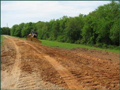
On-going projects include:
1. Yearly mowing program.
2. Chemical application at appropriate times throughout the year.
3. Chemical treatment of selected channels—the Board generally lets contract for chemical treatment of certain channels that are beyond the capabilities of the in-house chemical program.
4. Selected channel improvements— with Board approval, the letting of contracts for the purpose of cleaning and clearing out selected drainage channels. There are no contracts currently in effect. |


|
Regular Business Hours : Monday thru Friday 7:30 am to 4:00 pm |

|
LEVEE CERTIFICATION NEWS
The PAL (Provisionally Accredited Levee) Agreements between Caddo Levee District, Caddo Parish, City of Shreveport, Village of Belcher, Village of Gilliam, and Village of Hosston and FEMA were signed and the PAL Agreements became effective July 14, 2011. Pursuant to the said PAL Agreement, the levee district will have 24 months to complete the certification process. This process is currently well underway and the levee district is on schedule to timely complete the certification process.
This certification process requires the submission of various documents and data and an on-site inspection by a registered professional engineer. Upon receipt of this information, FEMA will review the data and documentation and confirm whether the levee will continue to provide protection from the base (one percent annual chance) flood. The following levees are subject to this certification process: Red River West Bank Levee, Black Bayou/Pine Island Levee East, West Agurs Levee and Cherokee Park Levee. The current effective flood maps in the area of Caddo Parish show these levees as accredited.
Contracts have been executed between Caddo Levee District and Freese and Nichols, Inc., an engineering firm, to perform the necessary evaluations for the certification process.. The contracts for engineering services for Red River South levee system and West Agurs levee system were executed on August 11, 2011. The contracts for engineering services for Red River North levee system and Black Bayou/Pine Island East levee system were executed on December 15, 2011. Contracts have been executed for certification of all of the required Caddo Parish levees.
Work on certification is currently underway and on schedule including mapping and engineering studies, surveys of levee systems, and exploratory borings. |
|
Online Sexual Harassment Course for State Employees > |